Explore Our Network of Sites
Search
By:
These 2021 builds are all more than just bike lanes — they represent political wins, Complete Streets projects and crucial connections that make up comprehensive bike networks.
In 2018, PeopleForBikes set out to create a proven model for how U.S. cities can systematically increase bicycle mobility. The playbook included tapping into existing community support for biking, amplifying that support with paid communications and thoughtful neighborhood-based engagement and empowering elected leaders to accelerate bike network construction. Three years later, we have tangible results — in Austin, Denver, New Orleans, Providence and Pittsburgh — that prove this strategy works.
The five cities above were part of a two-year partnership with PeopleForBikes dubbed The Final Mile. The project sought to accelerate the installation of complete mobility networks by providing cities with the necessary financial resources, as well as tactically helping them overcome the public opinion hurdles that too often delay progress. All of the participating cities understood that change was needed to meet mounting transportation needs and the urgency of climate change — and that complete bike networks were the best course of action.
Spoiler alert: All of our best bikeways for 2021 are in Final Mile cities. While that may not read as fair and impartial (sorry, Bike Twitter), we believe that bike lanes don’t live in isolation and that a commitment to a complete, safe and accessible network is what’s going to truly help transform bicycling in America. None of our picks are perfect, but they are all significant in their respective cities, key pieces of the built environment that help escalate sustainable momentum for bicycling.
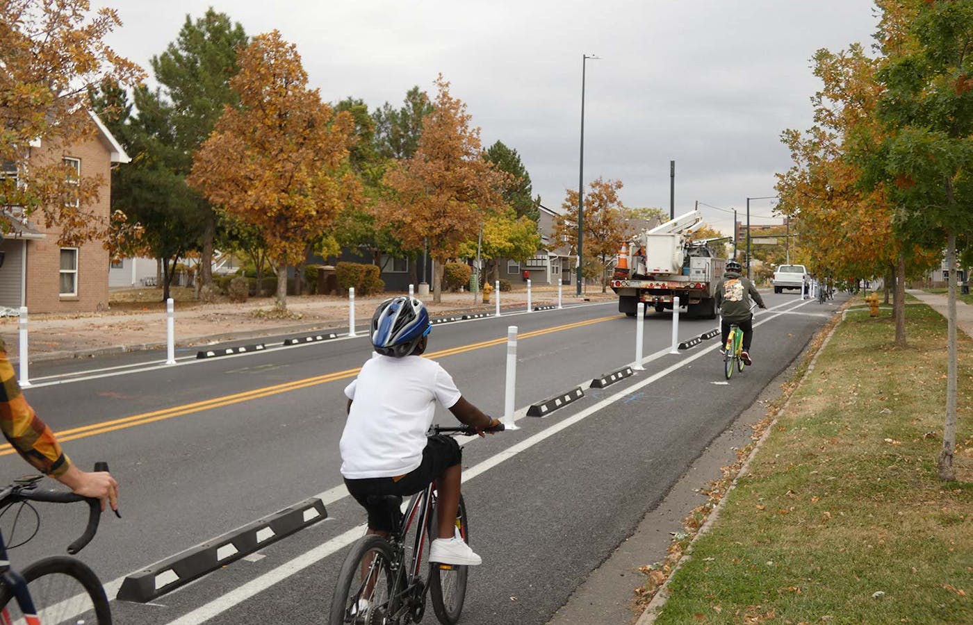
This protected bike lane, which was completed in October, connects downtown Denver to the westside Sun Valley neighborhood. For those unfamiliar with Denver, this project is a big deal due to the presence of interstate highway I-25, which divides the two areas, as well as the critical link between a more established downtown bike network and low-income neighborhoods to the southwest that have traditionally been underinvested in relative to other parts of the city.
“The Sun Valley neighborhood, in particular, is one of the most diverse neighborhoods in the city, and also one of the poorest,” said Jill Locantore, executive director of the Denver Streets Partnership. “It is really very close to downtown, as the crow flies, but until the 13th Ave. bike lane was installed, it was very difficult to get from Sun Valley to downtown via bike, particularly for new bike riders or families with kids who really need a high comfort facility to feel safe. So the bike lane makes a whole new way of getting around viable for the folks in that neighborhood.”
The bike lane was also upgraded based on community feedback, which speaks to the importance of outreach and engagement amongst community members and partners, as well as a broad media campaign. Denver set an ambitious goal of building a 990-mile connected, safe and comfortable bikeway system — 100 miles have been completed in the last two years alone, tripling the pace at which its planned network would be built. The West 13th Avenue route is a key part of the overall vision.
“[West 13th Avenue] provides a high comfort bike facility and connection between two crucial aspects of the Denver bike network,” said David C. Pulsipher, Denver Department of Transportation & Infrastructure (DOTI) city planner supervisor. “It connects downtown Denver with the South Platte River Trail, which carries a high volume of bicycle traffic both locally and regionally in the Denver Metro Area.”
Read more: How the Final Mile cities are working to break down barriers to bicycling.
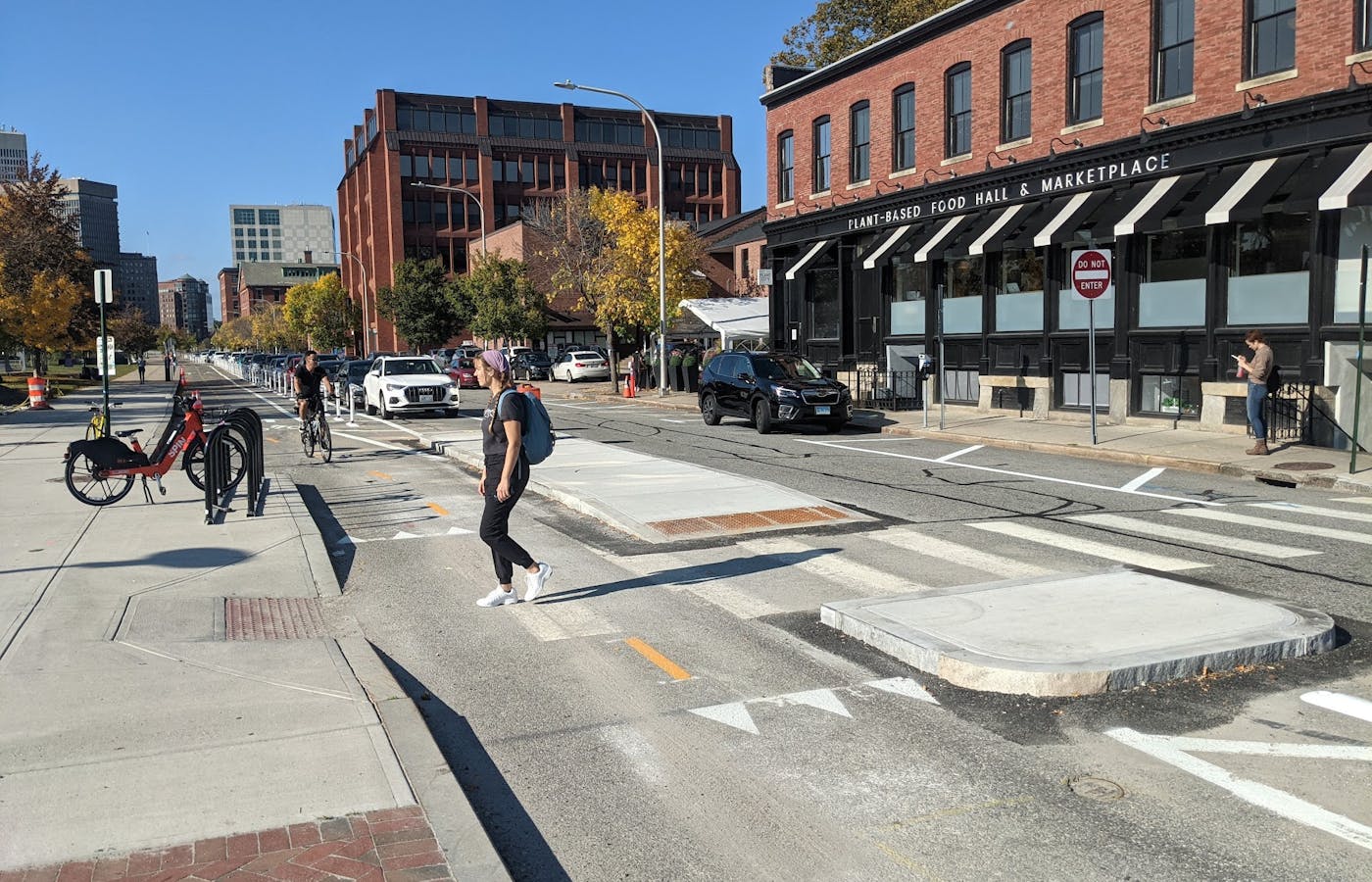
South Water Street used to be a highway ramp, under siege from speeding cars for years. Now, it’s a pedestrian-friendly destination. Far more than just a bike lane, the thoroughfare is a Complete Street, with new pedestrian crossings that make connecting to nearby Memorial Park safer and ADA-compliant, as well as bus islands that greatly improve people’s transit experience. The traffic calming has been a wild success: A study done one week after the project was completed found that there was an 84-96% reduction in the percent of vehicles traveling faster than 30 mph, a life-saving measure by any account.
“While this project faced significant pushback from businesses, institutions and a State DOT interested in preserving the status quo, neighborhood residents and forward-thinking elected officials were able to fight through it to the project's widely celebrated conclusion,” said Liza Burkin, lead organizer of the Providence Streets Coalition, which was instrumental in engaging residents around the project.
South Water Street’s infrastructure improvements mark a return to people-focused design for the area, which have not only strengthened Providence’s sense of community, but also help sustain momentum for 22 miles of bike lanes slated for construction in 2022. Crucially, the new bikeway connects the recently completed Michael Van Leesten Pedestrian and Bicycle Bridge — and new bicycle infrastructure on the other side of the bridge in downtown Providence — to the East Bay Bike Path, one of the state’s most popular trails for both recreation and commuting.
“The South Water Street bikeway closes a critical gap in Providence’s envisioned urban trail network,” said Martina Haggerty, director of special projects at the City of Providence Department of Planning and Development. “By connecting our neighborhoods to one another and regional assets like the East Bay Bike Path, we’re expanding access for thousands of people of all ages and abilities.”
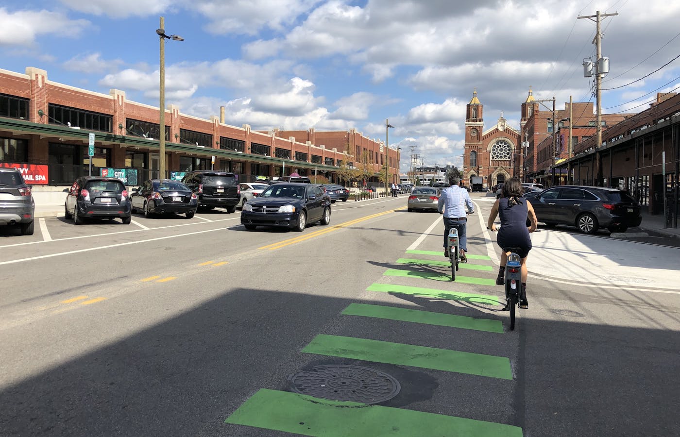
In a city with more than seven miles of protected bike lanes, some built in 2021, why would we honor this painted standard lane? While Smallman Street certainly isn’t one of the best bikeways in the true sense of the word, it does represent a significant win for bikes. In an era where even transportation is politicized, that counts for a lot.
Whereas before this four-block stretch of Smallman Street was completely wild, the redesign made it a little less chaotic. The painted bike lanes were accompanied by sidewalk improvements, new lighting and new crosswalks, making the entire area more appealing to pedestrians and bicyclists alike. Importantly, these improvements are located in the heart of Pittsburgh’s Strip District, which helped push the conversation forward regarding the need to create safe bike connections through the area. Scott Bricker, the executive director of BikePGH, is cautiously optimistic about what this accomplishment might mean for the district.
“Smallman Street is both significant and not very comfortable, especially with a bunch of people parking incorrectly,” said Bricker, noting that it’s designated back-in angle only. “But it did win some contested space for bikes at a time when the city had no appetite to carve out space for bikes on that street.”
While there are bike lanes at the periphery, there are currently none that extend through the Strip District, cutting off a neighborhood that’s undergoing major economic development. While a painted bike lane there might seem like a small gain, it established biking in an area that’s coming alive with art and restaurants — and it’s led to new community engagement opportunities for advocates and the city to build on. It's Bike Pittsburgh's hope that 2022 will kickstart a broader neighborhood planning process and be the year to connect the Strip to the surrounding bike lane network.
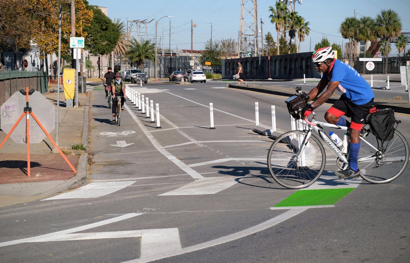
New Orleans suffered a lot of unforeseen challenges when it came to accelerating the buildout of its bike network, including the collapse of the Hard Rock Hotel in 2019, a cyber-attack in early 2020, damage caused by Hurricane Ida in 2021, complications with FEMA roadway projects and, of course, COVID-19, which hit the region especially hard. Despite the setbacks, city officials and the New Orleans Complete Streets Coalition formed a potent partnership that achieved far more together than either would have been able to accomplish alone. A prime example is the North Peters - Elysian Fields bikeway corridor, a roadway redesign with multiple safety and mobility benefits.
“This bikeway, like others in the Mayor’s Moving New Orleans program, resulted from listening to residents throughout the network planning and design processes,” said Jennifer E. Ruley, mobility and safety program lead at the city’s Department of Public Works. “Because Elysian Fields connects to other parts of our low-stress bikeway network, even more bike trips can be served.”
This bikeway, in the historic Marigny neighborhood, was completed through the conversion of a six-lane roadway to four lanes and the introduction of a parking-protected bike lane. Prior to this work, the .8-mile corridor had two bicyclist fatalities, one pedestrian fatality and numerous crashes involving injuries in the last seven years. For many, including Dan Farve, the former executive director of Bike Easy, the transformation of this stretch of Elysian Fields has been nothing short of amazing.
"I used to avoid it when riding, and now I go out of my way to enjoy the fun and comfy bikeway,” said Farve. “It gets me right to Crescent Park and — with the great, connected improvements to N. Peters — it's an easy shot in and out of the French Quarter."
Residents and business owners alike have attested to how much the redesign has benefited the area, noting how much easier and safer it is for folks to move around — not a small thing in any city, let alone one that sees a lot of tourists. This street transformation demonstrates that even busy streets can be made more comfortable for people who walk, bike, drive and use transit.
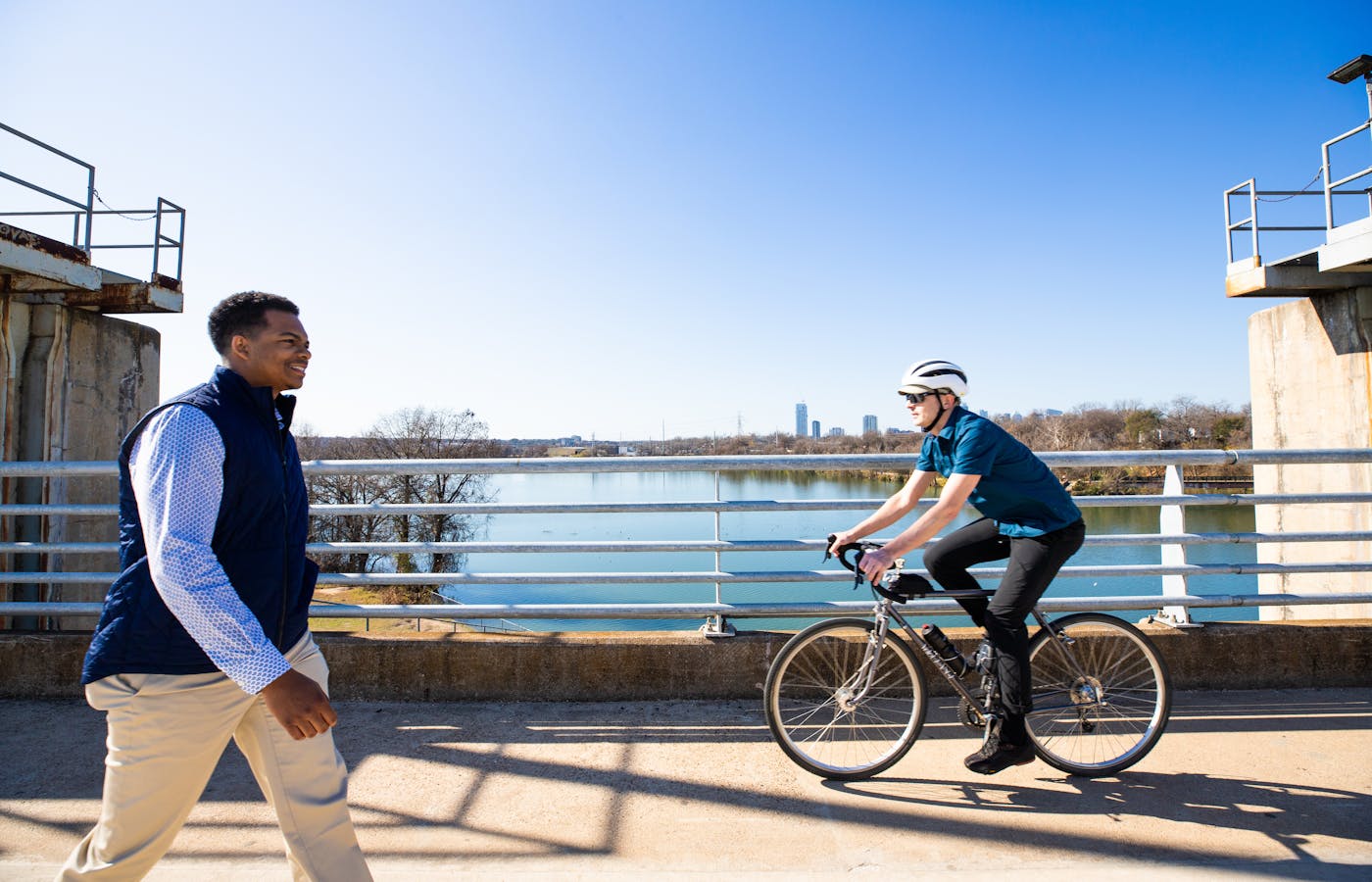
Austin is the clear standout among our five Final Mile cities. In two years, the Texas capitol finished 115 miles of new bike lanes and the city’s 400-mile all ages and abilities bicycle network is currently more than halfway complete with another 200 miles to be done by 2025. By then, 83% of Austin’s residents will be able to easily walk, bike or scoot using the AAA network, connecting them to destinations throughout the city.
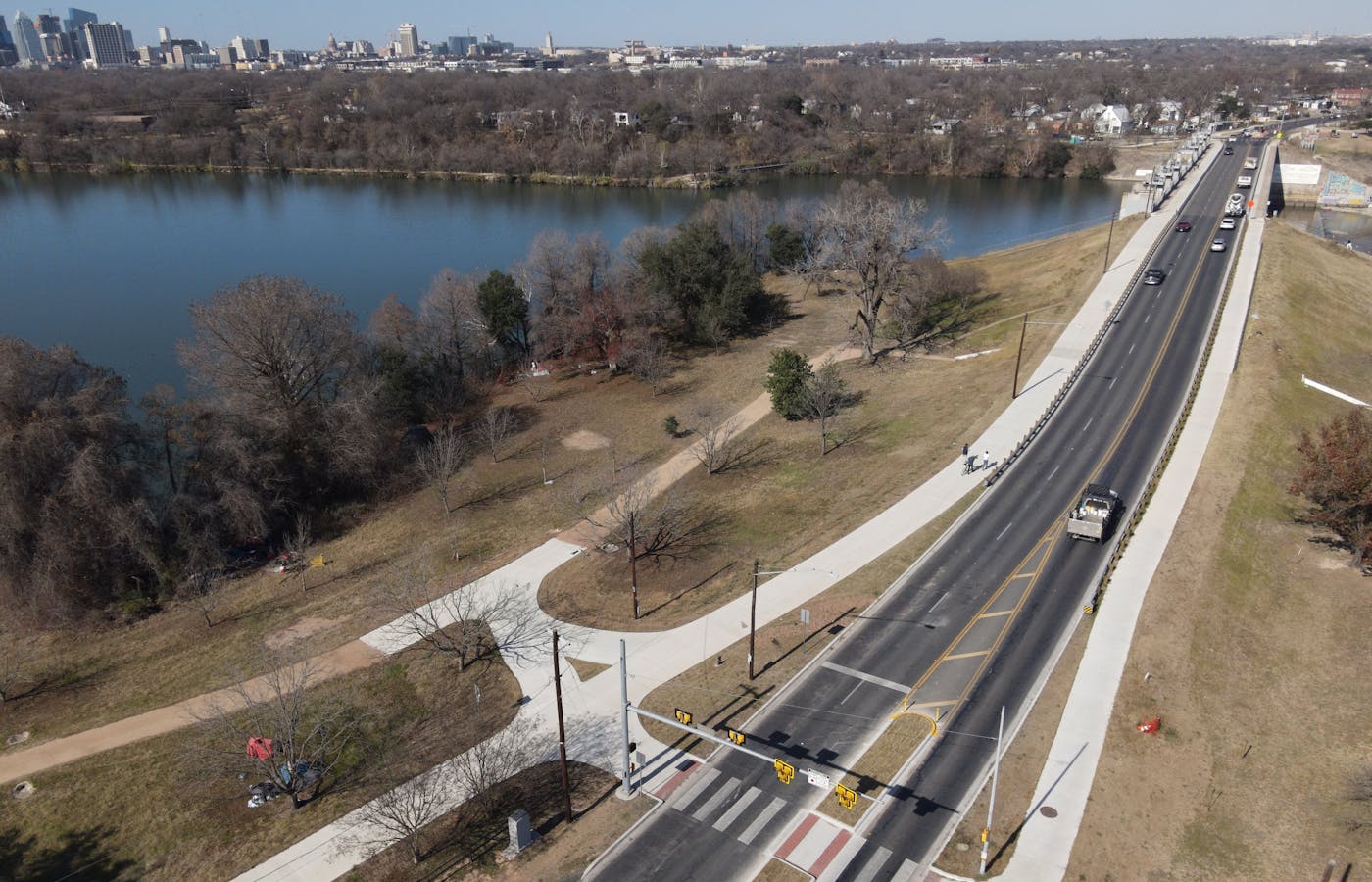
The Longhorn Dam Shared Use Path is a prime example of taking what a major barrier to biking and transforming it into a bikeway where anyone, from an 8-year-old or their 80-year-old grandmother, might feel comfortable bicycling. Among the east side residents that bore the brunt of the route’s previous safety risks, there has been a longtime desire to see the connection finally realized. After substantial community engagement, these immediate, interim improvements have been made while a brand new “wishbone” bicycle and pedestrian bridge is designed and built over the next five years. The pandemic prompted and accelerated action on the bikeway, which serves as an important connector between other bike paths.
“Our top priority is to improve the safety, comfort and connectivity for people on foot, using bicycles and personal mobility devices to get around Austin,” says Rob Spillar, director of Austin’s Department of Transportation. “This project shows what we can get done when we combine thoughtful community feedback, responsive agile design principles and data-driven programming. It also demonstrates how we can respond to areas of our community with the greatest need, making more equitable investments city-wide.”